Audiobooks by Valerio Di Stefano: Single Download - Complete Download [TAR] [WIM] [ZIP] [RAR] - Alphabetical Download  [TAR] [WIM] [ZIP] [RAR] - Download Instructions

Miguel de Cervantes y Saavedra - Don Quijote de la Mancha - Ebook:
HTML+ZIP- TXT - TXT+ZIP

Wikipedia for Schools (ES) - Static Wikipedia (ES) 2006
CLASSICISTRANIERI HOME PAGE - YOUTUBE CHANNEL
SITEMAP
Make a donation: IBAN: IT36M0708677020000000008016 - BIC/SWIFT:  ICRAITRRU60 - VALERIO DI STEFANO or
Privacy Policy Cookie Policy Terms and Conditions
ChamorroBible.org: March 2018, Psalm 89:11; Psalm 50:12; Psalm 24:1-2. Manguaguan na Palabran Si Yuus - God's Precious Words

Manguaguan na Palabran Si Yuus – God's Precious Words
Chamorro  ·  English

March 2018

The heavens are Thine, the earth also is Thine: as for the world and the fulness thereof, Thou hast founded them.

If I were hungry, I would not tell thee: for the world is Mine, and the fulness thereof.

The earth is the LORD'S, and the fulness thereof; the world, and they that dwell therein. For He hath founded it upon
the seas, and established it upon the floods.” Psalm 89:11; Psalm 50:12; Psalm 24:1-2, KJV.
(All English Bible verses are from the King James Version, KJV, Bible translation.)

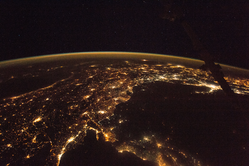
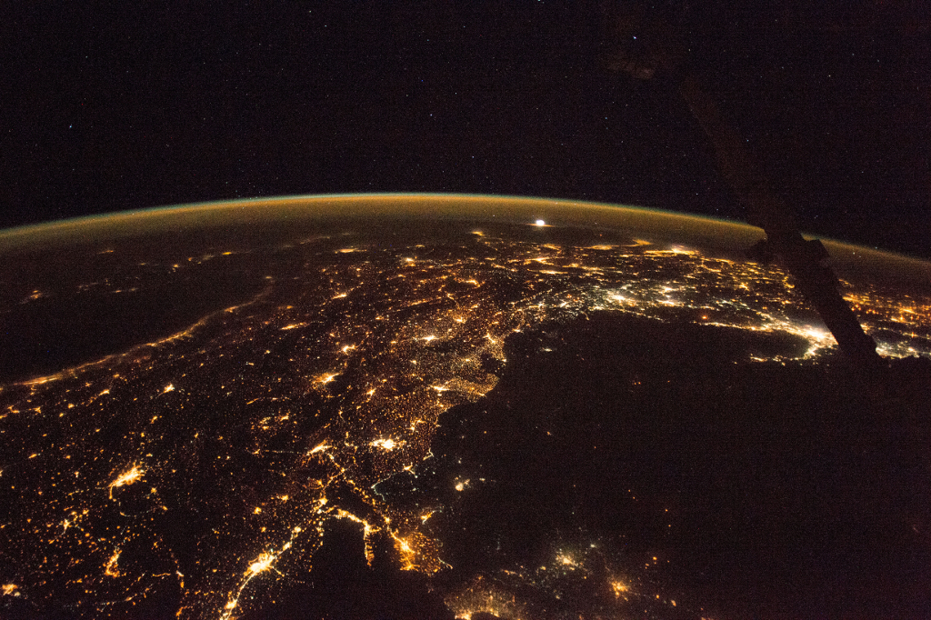
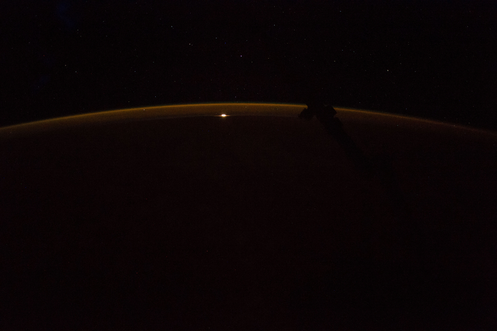
Photoset 1, Photograph 1. November 12, 2017 at 21:37:11 GMT, ISS053-E-218005, As Seen From the International Space Station (Expedition 53) While Orbiting Over the Mediterranean Sea, Latitude: 33.9, Longitude: 32.4, Altitude: 215 Nautical Miles, Sun Azimuth: 2 degrees, Sun Elevation Angle: -74 degrees. Photo Credit: NASA; ISS053-E-218005, International Space Station (Expedition 53); Image courtesy of the Earth Science and Remote Sensing Unit, NASA Johnson Space Center, https://eol.jsc.nasa.gov. National Aeronautics and Space Administration (NASA, http://www.nasa.gov), Government of the United States of America (USA).
Other   Original   Animated GIFs For Photoset 1
Photoset 1, Photograph 1. November 12, 2017 at 21:37:11 GMT, ISS053-E-218005
As Seen From the International Space Station (Expedition 53) While Orbiting Over the Mediterranean Sea

Latitude: 33.9 · Longitude: 32.4 · Altitude: 215 Nautical Miles · Sun Azimuth: 2° · Sun Elevation Angle: -74°
 
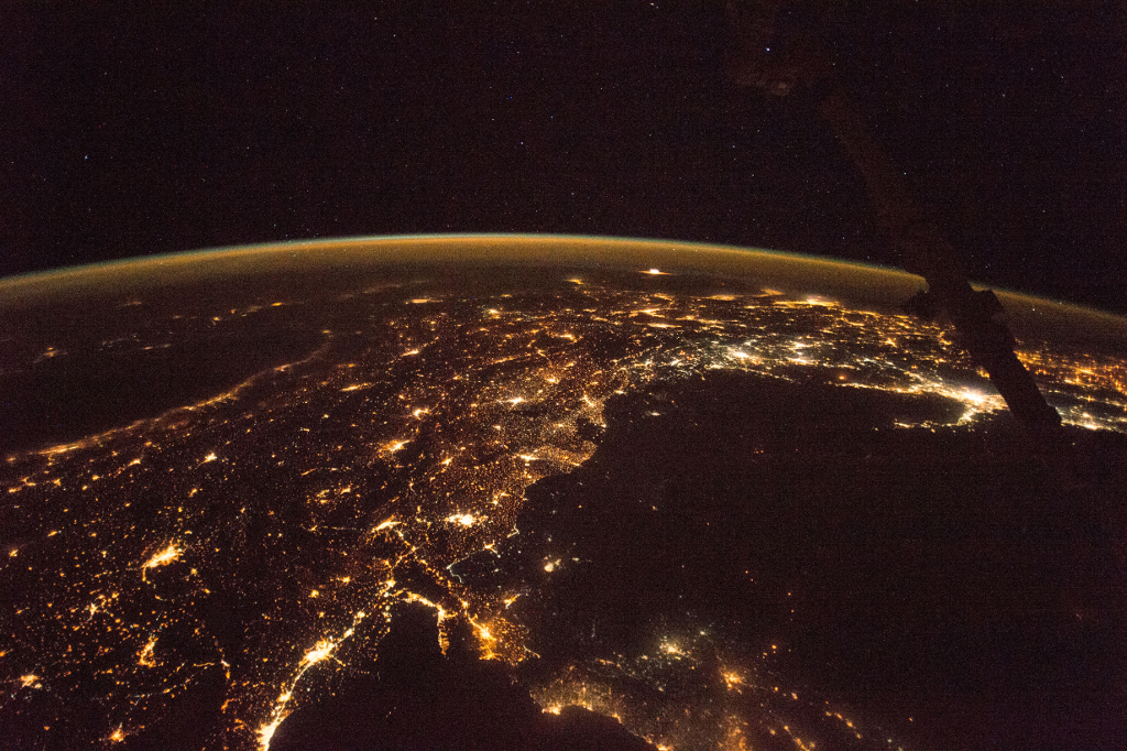
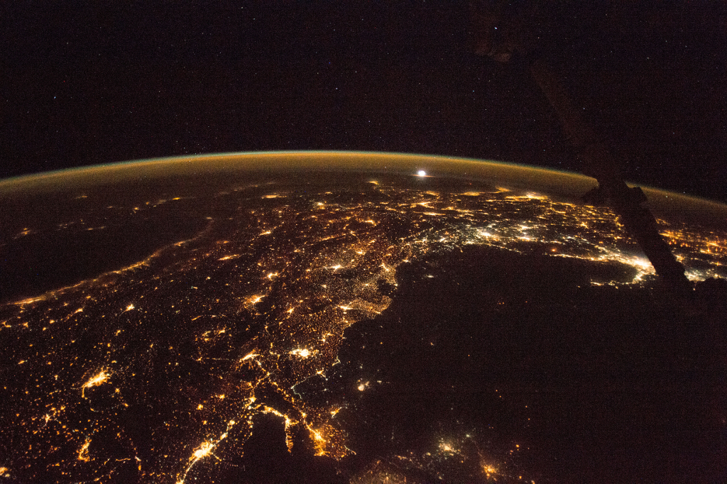
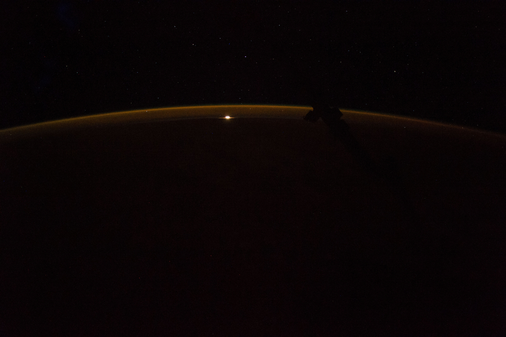
Photoset 1, Photograph 2. November 12, 2017 at 21:37:12 GMT, ISS053-E-218006, As Seen From the International Space Station (Expedition 53), Latitude: 34.0, Longitude: 32.5, Altitude: 215 Nautical Miles, Sun Azimuth: 3 degrees, Sun Elevation Angle: -74 degrees. Photo Credit: NASA; ISS053-E-218006, International Space Station (Expedition 53); Image courtesy of the Earth Science and Remote Sensing Unit, NASA Johnson Space Center, https://eol.jsc.nasa.gov. National Aeronautics and Space Administration (NASA, http://www.nasa.gov), Government of the United States of America (USA).
Other   Original   Animated GIFs For Photoset 1
Photoset 1, Photograph 2. November 12, 2017 at 21:37:12 GMT, ISS053-E-218006
As Seen From the International Space Station (Expedition 53)

Latitude: 34.0 · Longitude: 32.5 · Altitude: 215 Nautical Miles · Sun Azimuth: 3° · Sun Elevation Angle: -74°
 
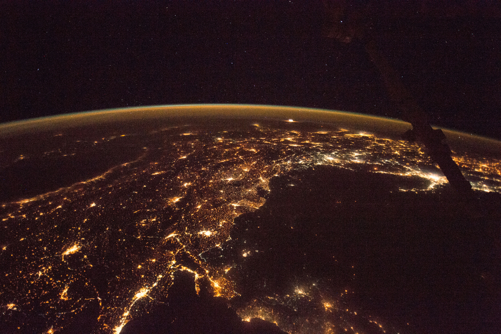
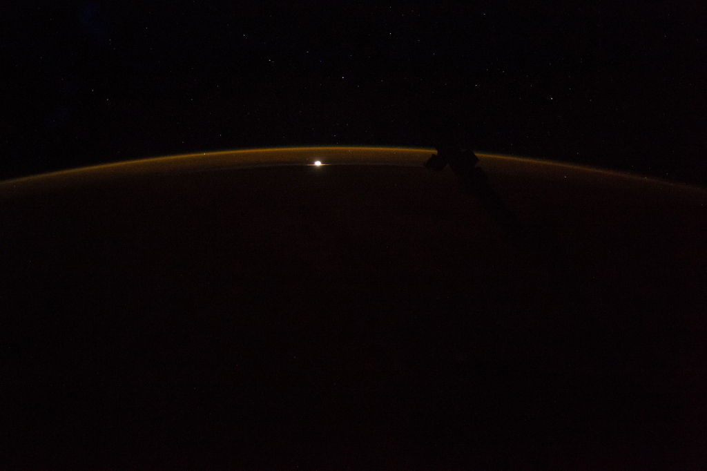
Photoset 1, Photograph 3. November 12, 2017 at 21:37:13 GMT, ISS053-E-218007, As Seen From the International Space Station (Expedition 53), Latitude: 34.0, Longitude: 32.5, Altitude: 215 Nautical Miles, Sun Azimuth: 3 degrees, Sun Elevation Angle: -74 degrees. Photo Credit: NASA; ISS053-E-218007, International Space Station (Expedition 53); Image courtesy of the Earth Science and Remote Sensing Unit, NASA Johnson Space Center, https://eol.jsc.nasa.gov. National Aeronautics and Space Administration (NASA, http://www.nasa.gov), Government of the United States of America (USA).
Other   Original   Animated GIFs For Photoset 1
Photoset 1, Photograph 3. November 12, 2017 at 21:37:13 GMT, ISS053-E-218007
As Seen From the International Space Station (Expedition 53)

Latitude: 34.0 · Longitude: 32.5 · Altitude: 215 Nautical Miles · Sun Azimuth: 3° · Sun Elevation Angle: -74°
 
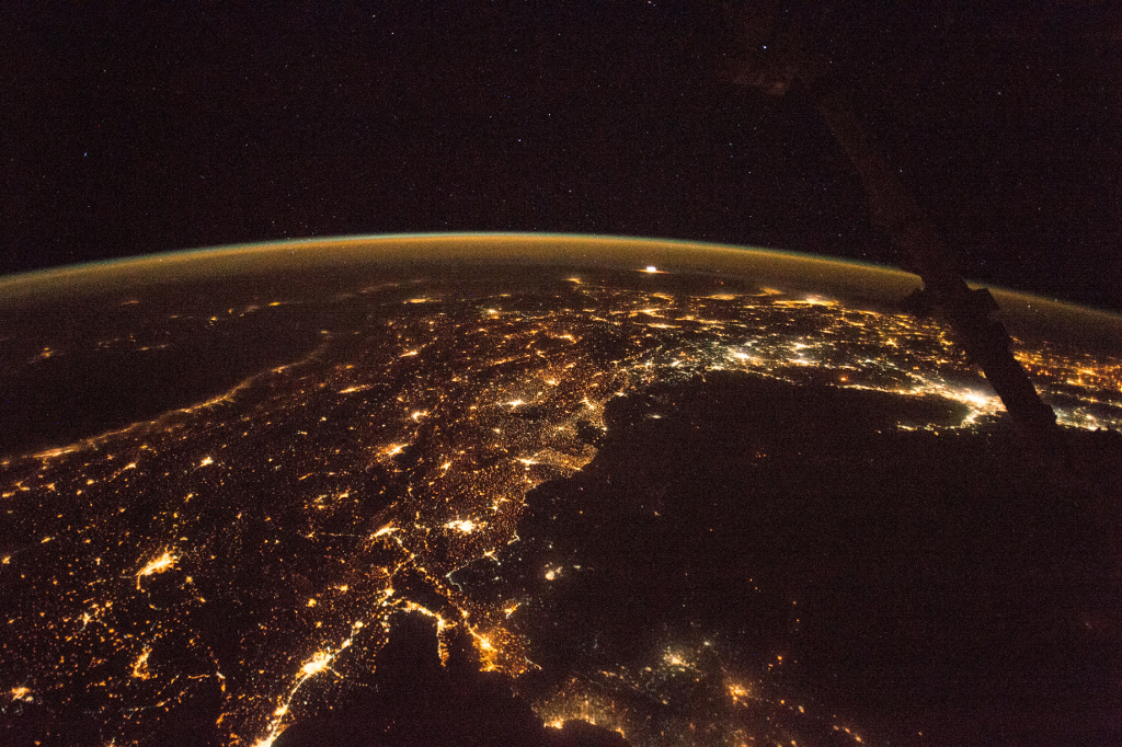
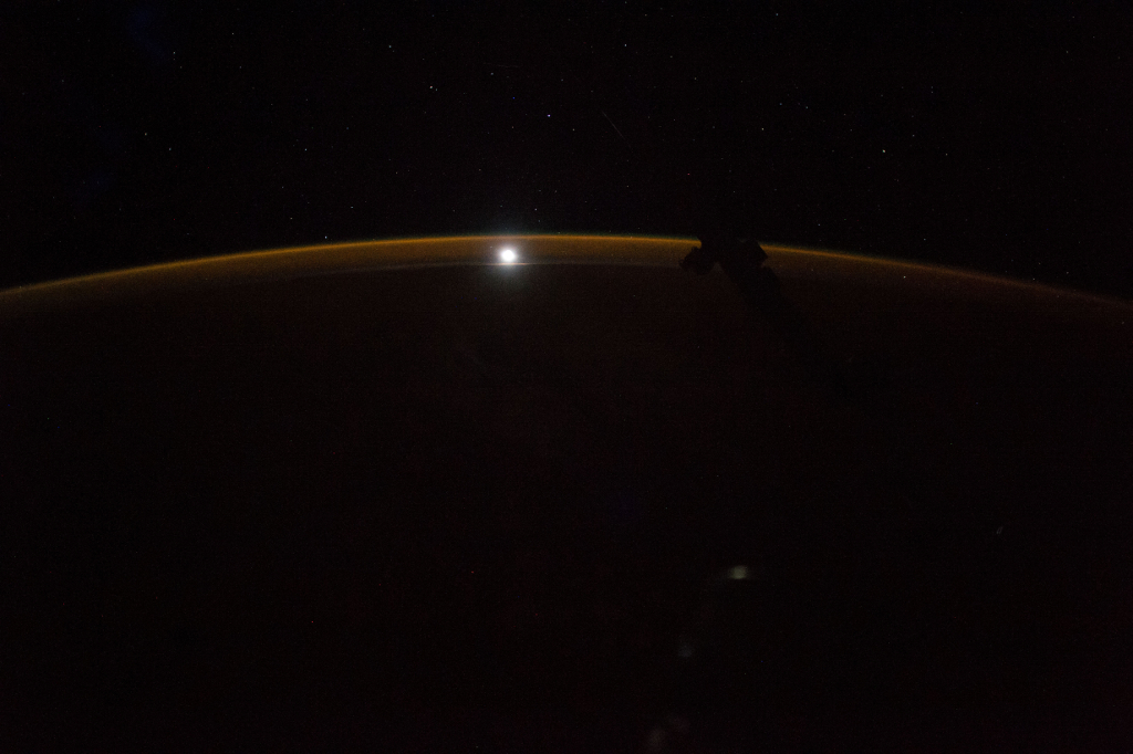
Photoset 1, Photograph 4. November 12, 2017 at 21:37:14 GMT, ISS053-E-218008, As Seen From the International Space Station (Expedition 53), Latitude: 34.1, Longitude: 32.6, Altitude: 215 Nautical Miles, Sun Azimuth: 3 degrees, Sun Elevation Angle: -74 degrees. Photo Credit: NASA; ISS053-E-218008, International Space Station (Expedition 53); Image courtesy of the Earth Science and Remote Sensing Unit, NASA Johnson Space Center, https://eol.jsc.nasa.gov. National Aeronautics and Space Administration (NASA, http://www.nasa.gov), Government of the United States of America (USA).
Other   Original   Animated GIFs For Photoset 1
Photoset 1, Photograph 4. November 12, 2017 at 21:37:14 GMT, ISS053-E-218008
As Seen From the International Space Station (Expedition 53)

Latitude: 34.1 · Longitude: 32.6 · Altitude: 215 Nautical Miles · Sun Azimuth: 3° · Sun Elevation Angle: -74°
 
Photoset 1, Photograph 5. November 12, 2017 at 21:37:15 GMT, ISS053-E-218009, As Seen From the International Space Station (Expedition 53), Latitude: 34.1, Longitude: 32.7, Altitude: 215 Nautical Miles, Sun Azimuth: 3 degrees, Sun Elevation Angle: -74 degrees. Photo Credit: NASA; ISS053-E-218009, International Space Station (Expedition 53); Image courtesy of the Earth Science and Remote Sensing Unit, NASA Johnson Space Center, https://eol.jsc.nasa.gov. National Aeronautics and Space Administration (NASA, http://www.nasa.gov), Government of the United States of America (USA).
Other   Original   Animated GIFs For Photoset 1
Photoset 1, Photograph 5. November 12, 2017 at 21:37:15 GMT, ISS053-E-218009
As Seen From the International Space Station (Expedition 53)

Latitude: 34.1 · Longitude: 32.7 · Altitude: 215 Nautical Miles · Sun Azimuth: 3° · Sun Elevation Angle: -74°
 
Photoset 1, Photograph 6. November 12, 2017 at 21:37:16 GMT, ISS053-E-218010, As Seen From the International Space Station (Expedition 53), Latitude: 34.2, Longitude: 32.7, Altitude: 215 Nautical Miles, Sun Azimuth: 3 degrees, Sun Elevation Angle: -74 degrees. Photo Credit: NASA; ISS053-E-218010, International Space Station (Expedition 53); Image courtesy of the Earth Science and Remote Sensing Unit, NASA Johnson Space Center, https://eol.jsc.nasa.gov. National Aeronautics and Space Administration (NASA, http://www.nasa.gov), Government of the United States of America (USA).
Other   Original   Animated GIFs For Photoset 1
Photoset 1, Photograph 6. November 12, 2017 at 21:37:16 GMT, ISS053-E-218010
As Seen From the International Space Station (Expedition 53)

Latitude: 34.2 · Longitude: 32.7 · Altitude: 215 Nautical Miles · Sun Azimuth: 3° · Sun Elevation Angle: -74°
 
Photoset 1, Photograph 7. November 12, 2017 at 21:37:17 GMT, ISS053-E-218011, As Seen From the International Space Station (Expedition 53), Latitude: 34.2, Longitude: 32.7, Altitude: 215 Nautical Miles, Sun Azimuth: 3 degrees, Sun Elevation Angle: -74 degrees. Photo Credit: NASA; ISS053-E-218011, International Space Station (Expedition 53); Image courtesy of the Earth Science and Remote Sensing Unit, NASA Johnson Space Center, https://eol.jsc.nasa.gov. National Aeronautics and Space Administration (NASA, http://www.nasa.gov), Government of the United States of America (USA).
Other   Original   Animated GIFs For Photoset 1
Photoset 1, Photograph 7. November 12, 2017 at 21:37:17 GMT, ISS053-E-218011
As Seen From the International Space Station (Expedition 53)

Latitude: 34.2 · Longitude: 32.7 · Altitude: 215 Nautical Miles · Sun Azimuth: 3° · Sun Elevation Angle: -74°
 
Photoset 1, Photograph 8. November 12, 2017 at 21:37:18 GMT, ISS053-E-218012, As Seen From the International Space Station (Expedition 53), Latitude: 34.2, Longitude: 32.8, Altitude: 215 Nautical Miles, Sun Azimuth: 4 degrees, Sun Elevation Angle: -74 degrees. Photo Credit: NASA; ISS053-E-218012, International Space Station (Expedition 53); Image courtesy of the Earth Science and Remote Sensing Unit, NASA Johnson Space Center, https://eol.jsc.nasa.gov. National Aeronautics and Space Administration (NASA, http://www.nasa.gov), Government of the United States of America (USA).
Other   Original   Animated GIFs For Photoset 1
Photoset 1, Photograph 8. November 12, 2017 at 21:37:18 GMT, ISS053-E-218012
As Seen From the International Space Station (Expedition 53)

Latitude: 34.2 · Longitude: 32.8 · Altitude: 215 Nautical Miles · Sun Azimuth: 4° · Sun Elevation Angle: -74°
 
Photoset 1, Photograph 9. November 12, 2017 at 21:37:19 GMT, ISS053-E-218013, As Seen From the International Space Station (Expedition 53), Latitude: 34.3, Longitude: 32.9, Altitude: 215 Nautical Miles, Sun Azimuth: 4 degrees, Sun Elevation Angle: -74 degrees. Photo Credit: NASA; ISS053-E-218013, International Space Station (Expedition 53); Image courtesy of the Earth Science and Remote Sensing Unit, NASA Johnson Space Center, https://eol.jsc.nasa.gov. National Aeronautics and Space Administration (NASA, http://www.nasa.gov), Government of the United States of America (USA).
Other   Original   Animated GIFs For Photoset 1
Photoset 1, Photograph 9. November 12, 2017 at 21:37:19 GMT, ISS053-E-218013
As Seen From the International Space Station (Expedition 53)

Latitude: 34.3 · Longitude: 32.9 · Altitude: 215 Nautical Miles · Sun Azimuth: 4° · Sun Elevation Angle: -74°
 
Photoset 1, Photograph 10. November 12, 2017 at 21:37:20 GMT, ISS053-E-218014 , As Seen From the International Space Station (Expedition 53), Latitude: 34.3, Longitude: 32.9, Altitude: 215 Nautical Miles, Sun Azimuth: 4 degrees, Sun Elevation Angle: -74 degrees. Photo Credit: NASA; ISS053-E-218014, International Space Station (Expedition 53); Image courtesy of the Earth Science and Remote Sensing Unit, NASA Johnson Space Center, https://eol.jsc.nasa.gov. National Aeronautics and Space Administration (NASA, http://www.nasa.gov), Government of the United States of America (USA).
Other   Original   Animated GIFs For Photoset 1
Photoset 1, Photograph 10. November 12, 2017 at 21:37:20 GMT, ISS053-E-218014
As Seen From the International Space Station (Expedition 53)

Latitude: 34.3 · Longitude: 32.9 · Altitude: 215 Nautical Miles · Sun Azimuth: 4° · Sun Elevation Angle: -74°
 
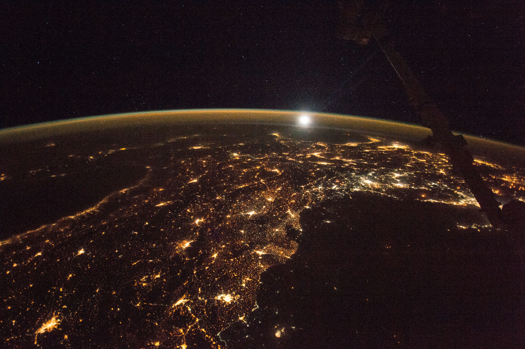
Photoset 1, Photograph 11. November 12, 2017 at 21:37:21 GMT, ISS053-E-218015, As Seen From the International Space Station (Expedition 53), Latitude: 34.4, Longitude: 33.0, Altitude: 215 Nautical Miles, Sun Azimuth: 4 degrees, Sun Elevation Angle: -74 degrees. Photo Credit: NASA; ISS053-E-218015, International Space Station (Expedition 53); Image courtesy of the Earth Science and Remote Sensing Unit, NASA Johnson Space Center, https://eol.jsc.nasa.gov. National Aeronautics and Space Administration (NASA, http://www.nasa.gov), Government of the United States of America (USA).
Other   Original   Animated GIFs For Photoset 1
Photoset 1, Photograph 11. November 12, 2017 at 21:37:21 GMT, ISS053-E-218015
As Seen From the International Space Station (Expedition 53)

Latitude: 34.4 · Longitude: 33.0 · Altitude: 215 Nautical Miles · Sun Azimuth: 4° · Sun Elevation Angle: -74°
 
Photoset 1, Photograph 12. November 12, 2017 at 21:37:36 GMT, ISS053-E-218030, As Seen From the International Space Station (Expedition 53), Latitude: 35.0, Longitude: 33.8, Altitude: 215 Nautical Miles, Sun Azimuth: 7 degrees, Sun Elevation Angle: -74 degrees. Photo Credit: NASA; ISS053-E-218030, International Space Station (Expedition 53); Image courtesy of the Earth Science and Remote Sensing Unit, NASA Johnson Space Center, https://eol.jsc.nasa.gov. National Aeronautics and Space Administration (NASA, http://www.nasa.gov), Government of the United States of America (USA).
Other   Original   Animated GIFs For Photoset 1
Photoset 1, Photograph 12. November 12, 2017 at 21:37:36 GMT, ISS053-E-218030
As Seen From the International Space Station (Expedition 53)

Latitude: 35.0 · Longitude: 33.8 · Altitude: 215 Nautical Miles · Sun Azimuth: 7° · Sun Elevation Angle: -74°
 
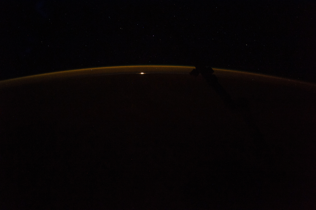
Photoset 1, Photograph 13. November 12, 2017 at 21:39:06 GMT, ISS053-E-218120, As Seen From the International Space Station (Expedition 53), Latitude: 38.7, Longitude: 39.1, Altitude: 215 Nautical Miles, Sun Azimuth: 20 degrees, Sun Elevation Angle: -68 degrees. Photo Credit: NASA; ISS053-E-218120, International Space Station (Expedition 53); Image courtesy of the Earth Science and Remote Sensing Unit, NASA Johnson Space Center, https://eol.jsc.nasa.gov. National Aeronautics and Space Administration (NASA, http://www.nasa.gov), Government of the United States of America (USA).
Other   Original   Animated GIFs For Photoset 1
Photoset 1, Photograph 13. November 12, 2017 at 21:39:06 GMT, ISS053-E-218120
As Seen From the International Space Station (Expedition 53)

Latitude: 38.7 · Longitude: 39.1 · Altitude: 215 Nautical Miles · Sun Azimuth: 20° · Sun Elevation Angle: -68°
 

Animated GIFs For Photoset 1

http://ChamorroBible.org/images/photos/gpw-201803-set1animate480-space-Earth-NASA-International-Space-Station-20171112.gif
480 x 319 pixels, 7053328 bytes

http://ChamorroBible.org/images/photos/gpw-201803-set1animate600-space-Earth-NASA-International-Space-Station-20171112.gif
600 x 399 pixels, 11430557 bytes

http://ChamorroBible.org/images/photos/gpw-201803-set1animate800-space-Earth-NASA-International-Space-Station-20171112.gif
800 x 532 pixels, 21479352 bytes

·

Photographs In All Photoset 1 Animated GIFs

ISS053-E-217990, ISS053-E-217995, ISS053-E-218000, ISS053-E-218005, ISS053-E-218010, ISS053-E-218015,
ISS053-E-218020, ISS053-E-218025, ISS053-E-218030, ISS053-E-218035, ISS053-E-218040, ISS053-E-218045,
ISS053-E-218050, ISS053-E-218055, ISS053-E-218060, ISS053-E-218065, ISS053-E-218070, ISS053-E-218075,
ISS053-E-218080, ISS053-E-218085, ISS053-E-218090, ISS053-E-218095, ISS053-E-218100, ISS053-E-218105,
ISS053-E-218110, ISS053-E-218115, ISS053-E-218120, ISS053-E-218125, ISS053-E-218130, ISS053-E-218135,
ISS053-E-218140, ISS053-E-218145, ISS053-E-218150, ISS053-E-218155, ISS053-E-218160, ISS053-E-218165,
ISS053-E-218170, ISS053-E-218175, ISS053-E-218180, ISS053-E-218185, ISS053-E-218190, ISS053-E-218195,
ISS053-E-218200, ISS053-E-218205, ISS053-E-218210, ISS053-E-218215, ISS053-E-218220, ISS053-E-218225,
ISS053-E-218230, ISS053-E-218235, ISS053-E-218240, ISS053-E-218245, ISS053-E-218250, ISS053-E-218255,
ISS053-E-218260, ISS053-E-218265, ISS053-E-218270, ISS053-E-218275, ISS053-E-218280, ISS053-E-218285,
ISS053-E-218290, ISS053-E-218295, ISS053-E-218300, ISS053-E-218305, ISS053-E-218310, ISS053-E-218315,
ISS053-E-218320, ISS053-E-218325, ISS053-E-218330, ISS053-E-218335, ISS053-E-218340, ISS053-E-218345

·

Photoset 1: 356 Sequential Photographs Dated November 12, 2017

NASA "Gateway to Astronaut Photography"
https://eol.jsc.nasa.gov/SearchPhotos/Technical.pl?SearchFeatCB=on&SearchCaptionCB=on&SearchPublicCB=on&day=12&year=2017&month=11&SearchGeonCB=on

From
ISS053-E-217990
Date: November 12, 2017
Time: 21:36:56 GMT
Nadir Latitude: 33.3, Nadir Longitude: 31.6
International Space Station Altitude: 215 Nautical Miles
Sun Azimuth: 359°
Sun Elevation Angle: -75°
URL: https://eol.jsc.nasa.gov/SearchPhotos/photo.pl?mission=ISS053&roll=E&frame=217990

To
ISS053-E-218345
Date: November 12, 2017
Time: 21:42:51 GMT
Nadir Latitude: 46.5, Nadir Longitude: 55.0
International Space Station Altitude: 214 Nautical Miles
Sun Azimuth: 44°
Sun Elevation Angle: -55°
URL: https://eol.jsc.nasa.gov/SearchPhotos/photo.pl?mission=ISS053&roll=E&frame=218345

ISS053-E-217990, ISS053-E-217991, ISS053-E-217992, ISS053-E-217993, ISS053-E-217994, ISS053-E-217995, ISS053-E-217996,
ISS053-E-217997, ISS053-E-217998, ISS053-E-217999, ISS053-E-218000, ISS053-E-218001, ISS053-E-218002, ISS053-E-218003,
ISS053-E-218004, ISS053-E-218005, ISS053-E-218006, ISS053-E-218007, ISS053-E-218008, ISS053-E-218009, ISS053-E-218010,
ISS053-E-218011, ISS053-E-218012, ISS053-E-218013, ISS053-E-218014, ISS053-E-218015, ISS053-E-218016, ISS053-E-218017,
ISS053-E-218018, ISS053-E-218019, ISS053-E-218020, ISS053-E-218021, ISS053-E-218022, ISS053-E-218023, ISS053-E-218024,
ISS053-E-218025, ISS053-E-218026, ISS053-E-218027, ISS053-E-218028, ISS053-E-218029, ISS053-E-218030, ISS053-E-218031,
ISS053-E-218032, ISS053-E-218033, ISS053-E-218034, ISS053-E-218035, ISS053-E-218036, ISS053-E-218037, ISS053-E-218038,
ISS053-E-218039, ISS053-E-218040, ISS053-E-218041, ISS053-E-218042, ISS053-E-218043, ISS053-E-218044, ISS053-E-218045,
ISS053-E-218046, ISS053-E-218047, ISS053-E-218048, ISS053-E-218049, ISS053-E-218050, ISS053-E-218051, ISS053-E-218052,
ISS053-E-218053, ISS053-E-218054, ISS053-E-218055, ISS053-E-218056, ISS053-E-218057, ISS053-E-218058, ISS053-E-218059,
ISS053-E-218060, ISS053-E-218061, ISS053-E-218062, ISS053-E-218063, ISS053-E-218064, ISS053-E-218065, ISS053-E-218066,
ISS053-E-218067, ISS053-E-218068, ISS053-E-218069, ISS053-E-218070, ISS053-E-218071, ISS053-E-218072, ISS053-E-218073,
ISS053-E-218074, ISS053-E-218075, ISS053-E-218076, ISS053-E-218077, ISS053-E-218078, ISS053-E-218079, ISS053-E-218080,
ISS053-E-218081, ISS053-E-218082, ISS053-E-218083, ISS053-E-218084, ISS053-E-218085, ISS053-E-218086, ISS053-E-218087,
ISS053-E-218088, ISS053-E-218089, ISS053-E-218090, ISS053-E-218091, ISS053-E-218092, ISS053-E-218093, ISS053-E-218094,
ISS053-E-218095, ISS053-E-218096, ISS053-E-218097, ISS053-E-218098, ISS053-E-218099, ISS053-E-218100, ISS053-E-218101,
ISS053-E-218102, ISS053-E-218103, ISS053-E-218104, ISS053-E-218105, ISS053-E-218106, ISS053-E-218107, ISS053-E-218108,
ISS053-E-218109, ISS053-E-218110, ISS053-E-218111, ISS053-E-218112, ISS053-E-218113, ISS053-E-218114, ISS053-E-218115,
ISS053-E-218116, ISS053-E-218117, ISS053-E-218118, ISS053-E-218119, ISS053-E-218120, ISS053-E-218121, ISS053-E-218122,
ISS053-E-218123, ISS053-E-218124, ISS053-E-218125, ISS053-E-218126, ISS053-E-218127, ISS053-E-218128, ISS053-E-218129,
ISS053-E-218130, ISS053-E-218131, ISS053-E-218132, ISS053-E-218133, ISS053-E-218134, ISS053-E-218135, ISS053-E-218136,
ISS053-E-218137, ISS053-E-218138, ISS053-E-218139, ISS053-E-218140, ISS053-E-218141, ISS053-E-218142, ISS053-E-218143,
ISS053-E-218144, ISS053-E-218145, ISS053-E-218146, ISS053-E-218147, ISS053-E-218148, ISS053-E-218149, ISS053-E-218150,
ISS053-E-218151, ISS053-E-218152, ISS053-E-218153, ISS053-E-218154, ISS053-E-218155, ISS053-E-218156, ISS053-E-218157,
ISS053-E-218158, ISS053-E-218159, ISS053-E-218160, ISS053-E-218161, ISS053-E-218162, ISS053-E-218163, ISS053-E-218164,
ISS053-E-218165, ISS053-E-218166, ISS053-E-218167, ISS053-E-218168, ISS053-E-218169, ISS053-E-218170, ISS053-E-218171,
ISS053-E-218172, ISS053-E-218173, ISS053-E-218174, ISS053-E-218175, ISS053-E-218176, ISS053-E-218177, ISS053-E-218178,
ISS053-E-218179, ISS053-E-218180, ISS053-E-218181, ISS053-E-218182, ISS053-E-218183, ISS053-E-218184, ISS053-E-218185,
ISS053-E-218186, ISS053-E-218187, ISS053-E-218188, ISS053-E-218189, ISS053-E-218190, ISS053-E-218191, ISS053-E-218192,
ISS053-E-218193, ISS053-E-218194, ISS053-E-218195, ISS053-E-218196, ISS053-E-218197, ISS053-E-218198, ISS053-E-218199,
ISS053-E-218200, ISS053-E-218201, ISS053-E-218202, ISS053-E-218203, ISS053-E-218204, ISS053-E-218205, ISS053-E-218206,
ISS053-E-218207, ISS053-E-218208, ISS053-E-218209, ISS053-E-218210, ISS053-E-218211, ISS053-E-218212, ISS053-E-218213,
ISS053-E-218214, ISS053-E-218215, ISS053-E-218216, ISS053-E-218217, ISS053-E-218218, ISS053-E-218219, ISS053-E-218220,
ISS053-E-218221, ISS053-E-218222, ISS053-E-218223, ISS053-E-218224, ISS053-E-218225, ISS053-E-218226, ISS053-E-218227,
ISS053-E-218228, ISS053-E-218229, ISS053-E-218230, ISS053-E-218231, ISS053-E-218232, ISS053-E-218233, ISS053-E-218234,
ISS053-E-218235, ISS053-E-218236, ISS053-E-218237, ISS053-E-218238, ISS053-E-218239, ISS053-E-218240, ISS053-E-218241,
ISS053-E-218242, ISS053-E-218243, ISS053-E-218244, ISS053-E-218245, ISS053-E-218246, ISS053-E-218247, ISS053-E-218248,
ISS053-E-218249, ISS053-E-218250, ISS053-E-218251, ISS053-E-218252, ISS053-E-218253, ISS053-E-218254, ISS053-E-218255,
ISS053-E-218256, ISS053-E-218257, ISS053-E-218258, ISS053-E-218259, ISS053-E-218260, ISS053-E-218261, ISS053-E-218262,
ISS053-E-218263, ISS053-E-218264, ISS053-E-218265, ISS053-E-218266, ISS053-E-218267, ISS053-E-218268, ISS053-E-218269,
ISS053-E-218270, ISS053-E-218271, ISS053-E-218272, ISS053-E-218273, ISS053-E-218274, ISS053-E-218275, ISS053-E-218276,
ISS053-E-218277, ISS053-E-218278, ISS053-E-218279, ISS053-E-218280, ISS053-E-218281, ISS053-E-218282, ISS053-E-218283,
ISS053-E-218284, ISS053-E-218285, ISS053-E-218286, ISS053-E-218287, ISS053-E-218288, ISS053-E-218289, ISS053-E-218290,
ISS053-E-218291, ISS053-E-218292, ISS053-E-218293, ISS053-E-218294, ISS053-E-218295, ISS053-E-218296, ISS053-E-218297,
ISS053-E-218298, ISS053-E-218299, ISS053-E-218300, ISS053-E-218301, ISS053-E-218302, ISS053-E-218303, ISS053-E-218304,
ISS053-E-218305, ISS053-E-218306, ISS053-E-218307, ISS053-E-218308, ISS053-E-218309, ISS053-E-218310, ISS053-E-218311,
ISS053-E-218312, ISS053-E-218313, ISS053-E-218314, ISS053-E-218315, ISS053-E-218316, ISS053-E-218317, ISS053-E-218318,
ISS053-E-218319, ISS053-E-218320, ISS053-E-218321, ISS053-E-218322, ISS053-E-218323, ISS053-E-218324, ISS053-E-218325,
ISS053-E-218326, ISS053-E-218327, ISS053-E-218328, ISS053-E-218329, ISS053-E-218330, ISS053-E-218331, ISS053-E-218332,
ISS053-E-218333, ISS053-E-218334, ISS053-E-218335, ISS053-E-218336, ISS053-E-218337, ISS053-E-218338, ISS053-E-218339,
ISS053-E-218340, ISS053-E-218341, ISS053-E-218342, ISS053-E-218343, ISS053-E-218344, ISS053-E-218345


Photoset 2, Photograph 1. November 12, 2017 at 09:14:09 GMT, ISS053-E-188905, As Seen From the International Space Station (Expedition 53), While Orbiting Above the North Pacific Ocean, Latitude: 27.8, Longitude: -146.2, Altitude: 216 Nautical Miles, Sun Azimuth: 340 degrees, Sun Elevation Angle: -80 degrees. Photo Credit: NASA; ISS053-E-188905, International Space Station (Expedition 53); Image courtesy of the Earth Science and Remote Sensing Unit, NASA Johnson Space Center, https://eol.jsc.nasa.gov. National Aeronautics and Space Administration (NASA, http://www.nasa.gov), Government of the United States of America (USA).
Other   Original   Animated GIFs For Photoset 2
Photoset 2, Photograph 1. November 12, 2017 at 09:14:09 GMT, ISS053-E-188905
As Seen From the International Space Station (Expedition 53) While Orbiting Above the North Pacific Ocean

Latitude: 27.8 · Longitude: -146.2 · Altitude: 216 Nautical Miles · Sun Azimuth: 340° · Sun Elevation Angle: -80°
 
As Seen From the International Space Station (Expedition 53), Latitude: 27.8, Longitude: -146.1, Altitude: 216 Nautical Miles, Sun Azimuth: 341 degrees, Sun Elevation Angle: -80 degrees. Photo Credit: ISS053-E-188906, International Space Station (Expedition 53); Image courtesy of the Earth Science and Remote Sensing Unit, NASA Johnson Space Center, https://eol.jsc.nasa.gov. National Aeronautics and Space Administration (NASA, http://www.nasa.gov), Government of the United States of America (USA).
Other   Original   Animated GIFs For Photoset 2
Photoset 2, Photograph 2. November 12, 2017 at 09:14:10 GMT, ISS053-E-188906
As Seen From the International Space Station (Expedition 53)

Latitude: 27.8 · Longitude: -146.1 · Altitude: 216 Nautical Miles · Sun Azimuth: 341° · Sun Elevation Angle: -80°
 
Photoset 2, Photograph 3. November 12, 2017 at 09:14:11 GMT, ISS053-E-188907, As Seen From the International Space Station (Expedition 53), Latitude: 27.9, Longitude: -146.1, Altitude: 216 Nautical Miles, Sun Azimuth: 341 degrees, Sun Elevation Angle: -80 degrees. Photo Credit: NASA; ISS053-E-188907, International Space Station (Expedition 53); Image courtesy of the Earth Science and Remote Sensing Unit, NASA Johnson Space Center, https://eol.jsc.nasa.gov. National Aeronautics and Space Administration (NASA, http://www.nasa.gov), Government of the United States of America (USA).
Other   Original   Animated GIFs For Photoset 2
Photoset 2, Photograph 3. November 12, 2017 at 09:14:11 GMT, ISS053-E-188907
As Seen From the International Space Station (Expedition 53)

Latitude: 27.9 · Longitude: -146.1 · Altitude: 216 Nautical Miles · Sun Azimuth: 341° · Sun Elevation Angle: -80°
 
Photoset 2, Photograph 4. November 12, 2017 at 09:14:12 GMT, ISS053-E-188908, As Seen From the International Space Station (Expedition 53), Latitude: 27.9, Longitude: -146.0, Altitude: 216 Nautical Miles, Sun Azimuth: 341 degrees, Sun Elevation Angle: -79 degrees. Photo Credit: NASA; ISS053-E-188908, International Space Station (Expedition 53); Image courtesy of the Earth Science and Remote Sensing Unit, NASA Johnson Space Center, https://eol.jsc.nasa.gov. National Aeronautics and Space Administration (NASA, http://www.nasa.gov), Government of the United States of America (USA).
Other   Original   Animated GIFs For Photoset 2
Photoset 2, Photograph 4. November 12, 2017 at 09:14:12 GMT, ISS053-E-188908
As Seen From the International Space Station (Expedition 53)

Latitude: 27.9 · Longitude: -146.0 · Altitude: 216 Nautical Miles · Sun Azimuth: 341° · Sun Elevation Angle: -79°
 
Photoset 2, Photograph 5. November 12, 2017 at 09:14:14 GMT, ISS053-E-188910, As Seen From the International Space Station (Expedition 53), Latitude: 28.0, Longitude: -146.0, Altitude: 216 Nautical Miles, Sun Azimuth: 342 degrees, Sun Elevation Angle: -79 degrees. Photo Credit: NASA; ISS053-E-188910, International Space Station (Expedition 53); Image courtesy of the Earth Science and Remote Sensing Unit, NASA Johnson Space Center, https://eol.jsc.nasa.gov. National Aeronautics and Space Administration (NASA, http://www.nasa.gov), Government of the United States of America (USA).
Other   Original   Animated GIFs For Photoset 2
Photoset 2, Photograph 5. November 12, 2017 at 09:14:14 GMT, ISS053-E-188910
As Seen From the International Space Station (Expedition 53)

Latitude: 28.0 · Longitude: -146.0 · Altitude: 216 Nautical Miles · Sun Azimuth: 342° · Sun Elevation Angle: -79°
 
Photoset 2, Photograph 6. November 12, 2017 at 09:14:24 GMT, ISS053-E-188920, As Seen From the International Space Station (Expedition 53), Latitude: 28.5, Longitude: -145.5, Altitude: 216 Nautical Miles, Sun Azimuth: 345 degrees, Sun Elevation Angle: -79 degrees. Photo Credit: NASA; ISS053-E-188920, International Space Station (Expedition 53); Image courtesy of the Earth Science and Remote Sensing Unit, NASA Johnson Space Center, https://eol.jsc.nasa.gov. National Aeronautics and Space Administration (NASA, http://www.nasa.gov), Government of the United States of America (USA).
Other   Original   Animated GIFs For Photoset 2
Photoset 2, Photograph 6. November 12, 2017 at 09:14:24 GMT, ISS053-E-188920
As Seen From the International Space Station (Expedition 53)

Latitude: 28.5 · Longitude: -145.5 · Altitude: 216 Nautical Miles · Sun Azimuth: 345° · Sun Elevation Angle: -79°
 
Photoset 2, Photograph 7. November 12, 2017 at 09:15:54 GMT, ISS053-E-189010, As Seen From the International Space Station (Expedition 53), Latitude: 32.6, Longitude: -141.0, Altitude: 216 Nautical Miles, Sun Azimuth: 7 degrees, Sun Elevation Angle: -75 degrees. Photo Credit: NASA; ISS053-E-189010, International Space Station (Expedition 53); Image courtesy of the Earth Science and Remote Sensing Unit, NASA Johnson Space Center, https://eol.jsc.nasa.gov. National Aeronautics and Space Administration (NASA, http://www.nasa.gov), Government of the United States of America (USA).
Other   Original   Animated GIFs For Photoset 2
Photoset 2, Photograph 7. November 12, 2017 at 09:15:54 GMT, ISS053-E-189010
As Seen From the International Space Station (Expedition 53)

Latitude: 32.6 · Longitude: -141.0 · Altitude: 216 Nautical Miles · Sun Azimuth: 7° · Sun Elevation Angle: -75°
 

Animated GIFs For Photoset 2

http://ChamorroBible.org/images/photos/gpw-201803-set2animate480-space-Earth-NASA-International-Space-Station-20171112.gif
480 x 319 pixels, 1629938 bytes

http://ChamorroBible.org/images/photos/gpw-201803-set2animate600-space-Earth-NASA-International-Space-Station-20171112.gif
600 x 399 pixels, 2595663 bytes

http://ChamorroBible.org/images/photos/gpw-201803-set2animate800-space-Earth-NASA-International-Space-Station-20171112.gif
800 x 532 pixels, 4838205 bytes

http://ChamorroBible.org/images/photos/gpw-201803-set2animate1200-space-Earth-NASA-International-Space-Station-20171112.gif
1200 x 799 pixels, 11919464 bytes

http://ChamorroBible.org/images/photos/gpw-201803-set2animate1500-space-Earth-NASA-International-Space-Station-20171112.gif
1500 x 998 pixels, 19867218 bytes

·

Photographs In All Photoset 2 Animated GIFs

ISS053-E-188900, ISS053-E-188901, ISS053-E-188902, ISS053-E-188903, ISS053-E-188904, ISS053-E-188905,
ISS053-E-188906, ISS053-E-188907, ISS053-E-188908, ISS053-E-188909, ISS053-E-188910, ISS053-E-188920,
ISS053-E-188930, ISS053-E-188940, ISS053-E-188950, ISS053-E-188960, ISS053-E-188970, ISS053-E-188980,
ISS053-E-188990, ISS053-E-189010, ISS053-E-189020, ISS053-E-189030, ISS053-E-189040, ISS053-E-189050,
ISS053-E-189060, ISS053-E-189070, ISS053-E-189080, ISS053-E-189090, ISS053-E-189100, ISS053-E-189110,
ISS053-E-189120, ISS053-E-189130, ISS053-E-189140, ISS053-E-189150, ISS053-E-189160, ISS053-E-189170,
ISS053-E-189180, ISS053-E-189190, ISS053-E-189200, ISS053-E-189210, ISS053-E-189211

·

Photoset 2: 312 Sequential Photographs Dated November 12, 2017

NASA "Gateway to Astronaut Photography"
https://eol.jsc.nasa.gov/SearchPhotos/Technical.pl?SearchFeatCB=on&SearchCaptionCB=on&SearchPublicCB=on&day=12&year=2017&month=11&SearchGeonCB=on

From
ISS053-E-188900
Date: November 12, 2017
Time: 09:14:04 GMT
Nadir Latitude: 27.6, Nadir Longitude: -146.4
International Space Station Altitude: 216 Nautical Miles
Sun Azimuth: 338°
Sun Elevation Angle: -80°
URL: https://eol.jsc.nasa.gov/SearchPhotos/photo.pl?mission=ISS053&roll=E&frame=188900

To
ISS053-E-189211
Date: November 12, 2017
Time: 09:19:15 GMT
Nadir Latitude: 40.8, Nadir Longitude: -129.2
International Space Station Altitude: 215 Nautical Miles
Sun Azimuth: 33°
Sun Elevation Angle: -64°
URL: https://eol.jsc.nasa.gov/SearchPhotos/photo.pl?mission=ISS053&roll=E&frame=189211

ISS053-E-188900, ISS053-E-188901, ISS053-E-188902, ISS053-E-188903, ISS053-E-188904, ISS053-E-188905, ISS053-E-188906,
ISS053-E-188907, ISS053-E-188908, ISS053-E-188909, ISS053-E-188910, ISS053-E-188911, ISS053-E-188912, ISS053-E-188913,
ISS053-E-188914, ISS053-E-188915, ISS053-E-188916, ISS053-E-188917, ISS053-E-188918, ISS053-E-188919, ISS053-E-188920,
ISS053-E-188921, ISS053-E-188922, ISS053-E-188923, ISS053-E-188924, ISS053-E-188925, ISS053-E-188926, ISS053-E-188927,
ISS053-E-188928, ISS053-E-188929, ISS053-E-188930, ISS053-E-188931, ISS053-E-188932, ISS053-E-188933, ISS053-E-188934,
ISS053-E-188935, ISS053-E-188936, ISS053-E-188937, ISS053-E-188938, ISS053-E-188939, ISS053-E-188940, ISS053-E-188941,
ISS053-E-188942, ISS053-E-188943, ISS053-E-188944, ISS053-E-188945, ISS053-E-188946, ISS053-E-188947, ISS053-E-188948,
ISS053-E-188949, ISS053-E-188950, ISS053-E-188951, ISS053-E-188952, ISS053-E-188953, ISS053-E-188954, ISS053-E-188955,
ISS053-E-188956, ISS053-E-188957, ISS053-E-188958, ISS053-E-188959, ISS053-E-188960, ISS053-E-188961, ISS053-E-188962,
ISS053-E-188963, ISS053-E-188964, ISS053-E-188965, ISS053-E-188966, ISS053-E-188967, ISS053-E-188968, ISS053-E-188969,
ISS053-E-188970, ISS053-E-188971, ISS053-E-188972, ISS053-E-188973, ISS053-E-188974, ISS053-E-188975, ISS053-E-188976,
ISS053-E-188977, ISS053-E-188978, ISS053-E-188979, ISS053-E-188980, ISS053-E-188981, ISS053-E-188982, ISS053-E-188983,
ISS053-E-188984, ISS053-E-188985, ISS053-E-188986, ISS053-E-188987, ISS053-E-188988, ISS053-E-188989, ISS053-E-188990,
ISS053-E-188991, ISS053-E-188992, ISS053-E-188993, ISS053-E-188994, ISS053-E-188995, ISS053-E-188996, ISS053-E-188997,
ISS053-E-188998, ISS053-E-188999, ISS053-E-189000, ISS053-E-189001, ISS053-E-189002, ISS053-E-189003, ISS053-E-189004,
ISS053-E-189005, ISS053-E-189006, ISS053-E-189007, ISS053-E-189008, ISS053-E-189009, ISS053-E-189010, ISS053-E-189011,
ISS053-E-189012, ISS053-E-189013, ISS053-E-189014, ISS053-E-189015, ISS053-E-189016, ISS053-E-189017, ISS053-E-189018,
ISS053-E-189019, ISS053-E-189020, ISS053-E-189021, ISS053-E-189022, ISS053-E-189023, ISS053-E-189024, ISS053-E-189025,
ISS053-E-189026, ISS053-E-189027, ISS053-E-189028, ISS053-E-189029, ISS053-E-189030, ISS053-E-189031, ISS053-E-189032,
ISS053-E-189033, ISS053-E-189034, ISS053-E-189035, ISS053-E-189036, ISS053-E-189037, ISS053-E-189038, ISS053-E-189039,
ISS053-E-189040, ISS053-E-189041, ISS053-E-189042, ISS053-E-189043, ISS053-E-189044, ISS053-E-189045, ISS053-E-189046,
ISS053-E-189047, ISS053-E-189048, ISS053-E-189049, ISS053-E-189050, ISS053-E-189051, ISS053-E-189052, ISS053-E-189053,
ISS053-E-189054, ISS053-E-189055, ISS053-E-189056, ISS053-E-189057, ISS053-E-189058, ISS053-E-189059, ISS053-E-189060,
ISS053-E-189061, ISS053-E-189062, ISS053-E-189063, ISS053-E-189064, ISS053-E-189065, ISS053-E-189066, ISS053-E-189067,
ISS053-E-189068, ISS053-E-189069, ISS053-E-189070, ISS053-E-189071, ISS053-E-189072, ISS053-E-189073, ISS053-E-189074,
ISS053-E-189075, ISS053-E-189076, ISS053-E-189077, ISS053-E-189078, ISS053-E-189079, ISS053-E-189080, ISS053-E-189081,
ISS053-E-189082, ISS053-E-189083, ISS053-E-189084, ISS053-E-189085, ISS053-E-189086, ISS053-E-189087, ISS053-E-189088,
ISS053-E-189089, ISS053-E-189090, ISS053-E-189091, ISS053-E-189092, ISS053-E-189093, ISS053-E-189094, ISS053-E-189095,
ISS053-E-189096, ISS053-E-189097, ISS053-E-189098, ISS053-E-189099, ISS053-E-189100, ISS053-E-189101, ISS053-E-189102,
ISS053-E-189103, ISS053-E-189104, ISS053-E-189105, ISS053-E-189106, ISS053-E-189107, ISS053-E-189108, ISS053-E-189109,
ISS053-E-189110, ISS053-E-189111, ISS053-E-189112, ISS053-E-189113, ISS053-E-189114, ISS053-E-189115, ISS053-E-189116,
ISS053-E-189117, ISS053-E-189118, ISS053-E-189119, ISS053-E-189120, ISS053-E-189121, ISS053-E-189122, ISS053-E-189123,
ISS053-E-189124, ISS053-E-189125, ISS053-E-189126, ISS053-E-189127, ISS053-E-189128, ISS053-E-189129, ISS053-E-189130,
ISS053-E-189131, ISS053-E-189132, ISS053-E-189133, ISS053-E-189134, ISS053-E-189135, ISS053-E-189136, ISS053-E-189137,
ISS053-E-189138, ISS053-E-189139, ISS053-E-189140, ISS053-E-189141, ISS053-E-189142, ISS053-E-189143, ISS053-E-189144,
ISS053-E-189145, ISS053-E-189146, ISS053-E-189147, ISS053-E-189148, ISS053-E-189149, ISS053-E-189150, ISS053-E-189151,
ISS053-E-189152, ISS053-E-189153, ISS053-E-189154, ISS053-E-189155, ISS053-E-189156, ISS053-E-189157, ISS053-E-189158,
ISS053-E-189159, ISS053-E-189160, ISS053-E-189161, ISS053-E-189162, ISS053-E-189163, ISS053-E-189164, ISS053-E-189165,
ISS053-E-189166, ISS053-E-189167, ISS053-E-189168, ISS053-E-189169, ISS053-E-189170, ISS053-E-189171, ISS053-E-189172,
ISS053-E-189173, ISS053-E-189174, ISS053-E-189175, ISS053-E-189176, ISS053-E-189177, ISS053-E-189178, ISS053-E-189179,
ISS053-E-189180, ISS053-E-189181, ISS053-E-189182, ISS053-E-189183, ISS053-E-189184, ISS053-E-189185, ISS053-E-189186,
ISS053-E-189187, ISS053-E-189188, ISS053-E-189189, ISS053-E-189190, ISS053-E-189191, ISS053-E-189192, ISS053-E-189193,
ISS053-E-189194, ISS053-E-189195, ISS053-E-189196, ISS053-E-189197, ISS053-E-189198, ISS053-E-189199, ISS053-E-189200,
ISS053-E-189201, ISS053-E-189202, ISS053-E-189203, ISS053-E-189204, ISS053-E-189205, ISS053-E-189206, ISS053-E-189207,
ISS053-E-189208, ISS053-E-189209, ISS053-E-189210, ISS053-E-189211


Photo Credits:

Photoset 1, Photograph 1. First Row (Full size Original-Local copy or Other): NASA; ISS053-E-218005, International Space Station (Expedition 53); Image courtesy of the Earth Science and Remote Sensing Unit, NASA Johnson Space Center, https://eol.jsc.nasa.gov. National Aeronautics and Space Administration (NASA, http://www.nasa.gov), Government of the United States of America (USA).

Photoset 1, Photograph 2. Second Row (Full size Original-Local copy or Other): NASA; ISS053-E-218006, International Space Station (Expedition 53); Image courtesy of the Earth Science and Remote Sensing Unit, NASA Johnson Space Center, https://eol.jsc.nasa.gov. National Aeronautics and Space Administration (NASA, http://www.nasa.gov), Government of the United States of America (USA).

Photoset 1, Photograph 3. Third Row (Full size Original-Local copy or Other): NASA; ISS053-E-218007, International Space Station (Expedition 53); Image courtesy of the Earth Science and Remote Sensing Unit, NASA Johnson Space Center, https://eol.jsc.nasa.gov. National Aeronautics and Space Administration (NASA, http://www.nasa.gov), Government of the United States of America (USA).

Photoset 1, Photograph 4. Fourth Row (Full size Original-Local copy or Other): NASA; ISS053-E-218008, International Space Station (Expedition 53); Image courtesy of the Earth Science and Remote Sensing Unit, NASA Johnson Space Center, https://eol.jsc.nasa.gov. National Aeronautics and Space Administration (NASA, http://www.nasa.gov), Government of the United States of America (USA).

Photoset 1, Photograph 5. Fifth Row (Full size Original-Local copy or Other): NASA; ISS053-E-218009, International Space Station (Expedition 53); Image courtesy of the Earth Science and Remote Sensing Unit, NASA Johnson Space Center, https://eol.jsc.nasa.gov. National Aeronautics and Space Administration (NASA, http://www.nasa.gov), Government of the United States of America (USA).

Photoset 1, Photograph 6. Sixth Row (Full size Original-Local copy or Other): NASA; ISS053-E-218010, International Space Station (Expedition 53); Image courtesy of the Earth Science and Remote Sensing Unit, NASA Johnson Space Center, https://eol.jsc.nasa.gov. National Aeronautics and Space Administration (NASA, http://www.nasa.gov), Government of the United States of America (USA).

Photoset 1, Photograph 7. Seventh Row (Full size Original-Local copy or Other): NASA; ISS053-E-218011, International Space Station (Expedition 53); Image courtesy of the Earth Science and Remote Sensing Unit, NASA Johnson Space Center, https://eol.jsc.nasa.gov. National Aeronautics and Space Administration (NASA, http://www.nasa.gov), Government of the United States of America (USA).

Photoset 1, Photograph 8. Eighth Row (Full size Original-Local copy or Other): NASA; ISS053-E-218012, International Space Station (Expedition 53); Image courtesy of the Earth Science and Remote Sensing Unit, NASA Johnson Space Center, https://eol.jsc.nasa.gov. National Aeronautics and Space Administration (NASA, http://www.nasa.gov), Government of the United States of America (USA).

Photoset 1, Photograph 9. Ninth Row (Full size Original-Local copy or Other): NASA; ISS053-E-218013, International Space Station (Expedition 53); Image courtesy of the Earth Science and Remote Sensing Unit, NASA Johnson Space Center, https://eol.jsc.nasa.gov. National Aeronautics and Space Administration (NASA, http://www.nasa.gov), Government of the United States of America (USA).

Photoset 1, Photograph 10. Tenth Row (Full size Original-Local copy or Other): NASA; ISS053-E-218014, International Space Station (Expedition 53); Image courtesy of the Earth Science and Remote Sensing Unit, NASA Johnson Space Center, https://eol.jsc.nasa.gov. National Aeronautics and Space Administration (NASA, http://www.nasa.gov), Government of the United States of America (USA).

Photoset 1, Photograph 11. Eleventh Row (Full size Original-Local copy or Other): NASA; ISS053-E-218015, International Space Station (Expedition 53); Image courtesy of the Earth Science and Remote Sensing Unit, NASA Johnson Space Center, https://eol.jsc.nasa.gov. National Aeronautics and Space Administration (NASA, http://www.nasa.gov), Government of the United States of America (USA).

Photoset 1, Photograph 12. Twelfth Row (Full size Original-Local copy or Other): NASA; ISS053-E-218030, International Space Station (Expedition 53); Image courtesy of the Earth Science and Remote Sensing Unit, NASA Johnson Space Center, https://eol.jsc.nasa.gov. National Aeronautics and Space Administration (NASA, http://www.nasa.gov), Government of the United States of America (USA).

Photoset 1, Photograph 13. Thirteenth Row (Full size Original-Local copy or Other): NASA; ISS053-E-218120, International Space Station (Expedition 53); Image courtesy of the Earth Science and Remote Sensing Unit, NASA Johnson Space Center, https://eol.jsc.nasa.gov. National Aeronautics and Space Administration (NASA, http://www.nasa.gov), Government of the United States of America (USA).

Photoset 2, Photograph 1. Fourteenth Row (Full size Original-Local copy or Other): NASA; ISS053-E-188905, International Space Station (Expedition 53); Image courtesy of the Earth Science and Remote Sensing Unit, NASA Johnson Space Center, https://eol.jsc.nasa.gov. National Aeronautics and Space Administration (NASA, http://www.nasa.gov), Government of the United States of America (USA).

Photoset 2, Photograph 2. Fifteenth Row (Full size Original-Local copy or Other): NASA; ISS053-E-188906, International Space Station (Expedition 53); Image courtesy of the Earth Science and Remote Sensing Unit, NASA Johnson Space Center, https://eol.jsc.nasa.gov. National Aeronautics and Space Administration (NASA, http://www.nasa.gov), Government of the United States of America (USA).

Photoset 2, Photograph 3. Sixteenth Row (Full size Original-Local copy or Other): NASA; ISS053-E-188907, International Space Station (Expedition 53); Image courtesy of the Earth Science and Remote Sensing Unit, NASA Johnson Space Center, https://eol.jsc.nasa.gov. National Aeronautics and Space Administration (NASA, http://www.nasa.gov), Government of the United States of America (USA).

Photoset 2, Photograph 4. Seventeenth Row (Full size Original-Local copy or Other): NASA; ISS053-E-188908, International Space Station (Expedition 53); Image courtesy of the Earth Science and Remote Sensing Unit, NASA Johnson Space Center, https://eol.jsc.nasa.gov. National Aeronautics and Space Administration (NASA, http://www.nasa.gov), Government of the United States of America (USA).

Photoset 2, Photograph 5. Eighteenth Row (Full size Original-Local copy or Other): NASA; ISS053-E-188910, International Space Station (Expedition 53); Image courtesy of the Earth Science and Remote Sensing Unit, NASA Johnson Space Center, https://eol.jsc.nasa.gov. National Aeronautics and Space Administration (NASA, http://www.nasa.gov), Government of the United States of America (USA).

Photoset 2, Photograph 6. Nineteenth Row (Full size Original-Local copy or Other): NASA; ISS053-E-188920, International Space Station (Expedition 53); Image courtesy of the Earth Science and Remote Sensing Unit, NASA Johnson Space Center, https://eol.jsc.nasa.gov. National Aeronautics and Space Administration (NASA, http://www.nasa.gov), Government of the United States of America (USA).

Photoset 2, Photograph 7. Twentieth Row (Full size Original-Local copy or Other): NASA; ISS053-E-189010, International Space Station (Expedition 53); Image courtesy of the Earth Science and Remote Sensing Unit, NASA Johnson Space Center, https://eol.jsc.nasa.gov. National Aeronautics and Space Administration (NASA, http://www.nasa.gov), Government of the United States of America (USA).

The Manguaguan na Palabran Si Yuus Archive
The Great Earthquake and Catastrophic Tsunami of 2004
The Spectacular Clouds of the Transonic Flight Regime
The Chamorro Bible In Print


ChamorroBible.org  ·  Francis Marion Price (1850-1937)  ·  The 1908 Chamorro Bible in Audio  ·  Chamorro Language Resources  ·  Acknowledgements  ·  ISLES, Spring 2003, Special Issue: The Resurrection of the (1908) Chamorro Bible  ·  Chamorro Bible Project  ·  Announcements  ·  Download

Static Wikipedia 2008 (no images)

aa - ab - af - ak - als - am - an - ang - ar - arc - as - ast - av - ay - az - ba - bar - bat_smg - bcl - be - be_x_old - bg - bh - bi - bm - bn - bo - bpy - br - bs - bug - bxr - ca - cbk_zam - cdo - ce - ceb - ch - cho - chr - chy - co - cr - crh - cs - csb - cu - cv - cy - da - de - diq - dsb - dv - dz - ee - el - eml - en - eo - es - et - eu - ext - fa - ff - fi - fiu_vro - fj - fo - fr - frp - fur - fy - ga - gan - gd - gl - glk - gn - got - gu - gv - ha - hak - haw - he - hi - hif - ho - hr - hsb - ht - hu - hy - hz - ia - id - ie - ig - ii - ik - ilo - io - is - it - iu - ja - jbo - jv - ka - kaa - kab - kg - ki - kj - kk - kl - km - kn - ko - kr - ks - ksh - ku - kv - kw - ky - la - lad - lb - lbe - lg - li - lij - lmo - ln - lo - lt - lv - map_bms - mdf - mg - mh - mi - mk - ml - mn - mo - mr - mt - mus - my - myv - mzn - na - nah - nap - nds - nds_nl - ne - new - ng - nl - nn - no - nov - nrm - nv - ny - oc - om - or - os - pa - pag - pam - pap - pdc - pi - pih - pl - pms - ps - pt - qu - quality - rm - rmy - rn - ro - roa_rup - roa_tara - ru - rw - sa - sah - sc - scn - sco - sd - se - sg - sh - si - simple - sk - sl - sm - sn - so - sr - srn - ss - st - stq - su - sv - sw - szl - ta - te - tet - tg - th - ti - tk - tl - tlh - tn - to - tpi - tr - ts - tt - tum - tw - ty - udm - ug - uk - ur - uz - ve - vec - vi - vls - vo - wa - war - wo - wuu - xal - xh - yi - yo - za - zea - zh - zh_classical - zh_min_nan - zh_yue - zu -

Static Wikipedia 2007 (no images)

aa - ab - af - ak - als - am - an - ang - ar - arc - as - ast - av - ay - az - ba - bar - bat_smg - bcl - be - be_x_old - bg - bh - bi - bm - bn - bo - bpy - br - bs - bug - bxr - ca - cbk_zam - cdo - ce - ceb - ch - cho - chr - chy - co - cr - crh - cs - csb - cu - cv - cy - da - de - diq - dsb - dv - dz - ee - el - eml - en - eo - es - et - eu - ext - fa - ff - fi - fiu_vro - fj - fo - fr - frp - fur - fy - ga - gan - gd - gl - glk - gn - got - gu - gv - ha - hak - haw - he - hi - hif - ho - hr - hsb - ht - hu - hy - hz - ia - id - ie - ig - ii - ik - ilo - io - is - it - iu - ja - jbo - jv - ka - kaa - kab - kg - ki - kj - kk - kl - km - kn - ko - kr - ks - ksh - ku - kv - kw - ky - la - lad - lb - lbe - lg - li - lij - lmo - ln - lo - lt - lv - map_bms - mdf - mg - mh - mi - mk - ml - mn - mo - mr - mt - mus - my - myv - mzn - na - nah - nap - nds - nds_nl - ne - new - ng - nl - nn - no - nov - nrm - nv - ny - oc - om - or - os - pa - pag - pam - pap - pdc - pi - pih - pl - pms - ps - pt - qu - quality - rm - rmy - rn - ro - roa_rup - roa_tara - ru - rw - sa - sah - sc - scn - sco - sd - se - sg - sh - si - simple - sk - sl - sm - sn - so - sr - srn - ss - st - stq - su - sv - sw - szl - ta - te - tet - tg - th - ti - tk - tl - tlh - tn - to - tpi - tr - ts - tt - tum - tw - ty - udm - ug - uk - ur - uz - ve - vec - vi - vls - vo - wa - war - wo - wuu - xal - xh - yi - yo - za - zea - zh - zh_classical - zh_min_nan - zh_yue - zu -

Static Wikipedia 2006 (no images)

aa - ab - af - ak - als - am - an - ang - ar - arc - as - ast - av - ay - az - ba - bar - bat_smg - bcl - be - be_x_old - bg - bh - bi - bm - bn - bo - bpy - br - bs - bug - bxr - ca - cbk_zam - cdo - ce - ceb - ch - cho - chr - chy - co - cr - crh - cs - csb - cu - cv - cy - da - de - diq - dsb - dv - dz - ee - el - eml - eo - es - et - eu - ext - fa - ff - fi - fiu_vro - fj - fo - fr - frp - fur - fy - ga - gan - gd - gl - glk - gn - got - gu - gv - ha - hak - haw - he - hi - hif - ho - hr - hsb - ht - hu - hy - hz - ia - id - ie - ig - ii - ik - ilo - io - is - it - iu - ja - jbo - jv - ka - kaa - kab - kg - ki - kj - kk - kl - km - kn - ko - kr - ks - ksh - ku - kv - kw - ky - la - lad - lb - lbe - lg - li - lij - lmo - ln - lo - lt - lv - map_bms - mdf - mg - mh - mi - mk - ml - mn - mo - mr - mt - mus - my - myv - mzn - na - nah - nap - nds - nds_nl - ne - new - ng - nl - nn - no - nov - nrm - nv - ny - oc - om - or - os - pa - pag - pam - pap - pdc - pi - pih - pl - pms - ps - pt - qu - quality - rm - rmy - rn - ro - roa_rup - roa_tara - ru - rw - sa - sah - sc - scn - sco - sd - se - sg - sh - si - simple - sk - sl - sm - sn - so - sr - srn - ss - st - stq - su - sv - sw - szl - ta - te - tet - tg - th - ti - tk - tl - tlh - tn - to - tpi - tr - ts - tt - tum - tw - ty - udm - ug - uk - ur - uz - ve - vec - vi - vls - vo - wa - war - wo - wuu - xal - xh - yi - yo - za - zea - zh - zh_classical - zh_min_nan - zh_yue - zu -

Sub-domains

CDRoms - Magnatune - Librivox - Liber Liber - Encyclopaedia Britannica - Project Gutenberg - Wikipedia 2008 - Wikipedia 2007 - Wikipedia 2006 -

Other Domains

https://www.classicistranieri.it - https://www.ebooksgratis.com - https://www.gutenbergaustralia.com - https://www.englishwikipedia.com - https://www.wikipediazim.com - https://www.wikisourcezim.com - https://www.projectgutenberg.net - https://www.projectgutenberg.es - https://www.radioascolto.com - https://www.debitoformativo.it - https://www.wikipediaforschools.org - https://www.projectgutenbergzim.com